Beyond the Book: Maps and Blueprints
Susan Howell, Southern Illinois University Carbondale
William Schlaack, University of Illinois at Urbana-Champaign
Unlike other topics in this series, maps and blueprints are primarily paper, thus require the same care and consideration as other paper materials. Maps and blueprints do, however, pose their own unique challenges such as size, storage, and use. Additionally, unlike books, they do not have a binding or protective covers. How a map is stored significantly contributes to its long-term preservation. Optimally, maps should be stored flat in map cases made of chemically stable materials.
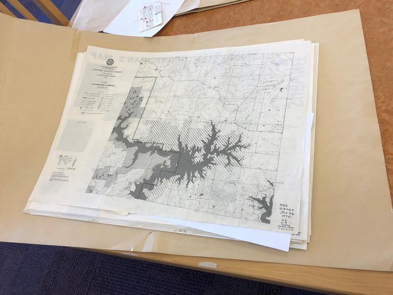
Anyone who has ever used a print map likely has experienced some difficulty trying to re-fold the map once it has been unfolded. Every time a map is unfolded and re-folded, it causes wear and tear on the map. Each fold is a place of vulnerability. If the map is folded, it should be folded with the grain to minimize damage. At Southern Illinois University Carbondale (SIUC) Morris Library, we do have some folded maps stored in vertical file map cases. These are maps that will be superseded shortly or are not expected to be retained for the long term.
Upon receipt of a map, the first decision made is whether it will be stored folded or flat. Maps that are received rolled should be flattened when they are received if they are to be stored flat. Morris Library’s more valuable and unique maps are stored flat in map cases. Some of our maps, primarily sets, are placed in folders made with acid free Bristol board. Folders should be at least two inches shorter and narrower than the drawer and one inch longer and wider than the map (Reike, 1985). When these folders are placed in the drawers of the map cases, the folded edge faces the front edge of the drawer. Placing maps in folders puts the wear and tear imposed by taking the maps in and out of the drawer on the folder instead of the maps. Folders also protect maps from soiling, liquids, marking, light and slow deterioration of the paper.
Morris Library has chosen to encapsulate some maps. Polyester (Mylar) encapsulation provides physical support for fragile and brittle maps. Once they are encapsulated they are protected from moisture and marking. Unfortunately, it does not prevent the acidic paper from becoming brittle. To prevent creating a microenvironment for the map to off-gas and destroy itself, a two inch gap is left for air circulation which allows the map to breathe. Another option that Morris Library uses is to create an L sleeve (sealing two adjacent sides) which allows more air to circulate, but does not completely protect the map from outside elements. If a map is one-sided, a sheet of buffered paper can be placed on the non-print side to slow deterioration. Morris Library uses an encapsulating machine, but encapsulation can be done manually. The Alaska State Libraries training manual listed in the resources section at the end of this article provides instructions for this process. Since encapsulation is costly and time consuming, only the most vulnerable maps are encapsulated. Other criteria we use to guide our decision to encapsulate includes the value of the map, its significance to the mission of our library, and user demand. Encapsulation offers the greatest protection for maps that are going to be handled by patrons. The maps can be viewed on both sides without touching the actual map. One of the biggest advantages of encapsulation is that it is completely reversible. The downside is that it adds weight and bulk to the drawer.
At times, Morris Library has acquired maps too fragile to withstand the encapsulation process. One example of this was a map donated to our library by John A. Logan College. It was already extremely brittle. We did not have the resources to send it out to a conservator. Our goal was to stabilize it until we could have a conservator work on it. We made an enclosure for it to create an environment that would slow down further deterioration and minimize handling of the actual map. The enclosure is kept in the map case room of Special Collections which is controlled for temperature and humidity.
Digitization is another option, but the startup is expensive as it requires large-format scanners. The greatest advantage of digitization is that after a map is scanned it can be used without touching the physical object, saving it from wear and tear of use. It may potentially reach a wider patron base as well.
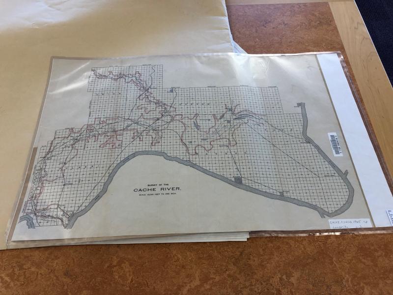
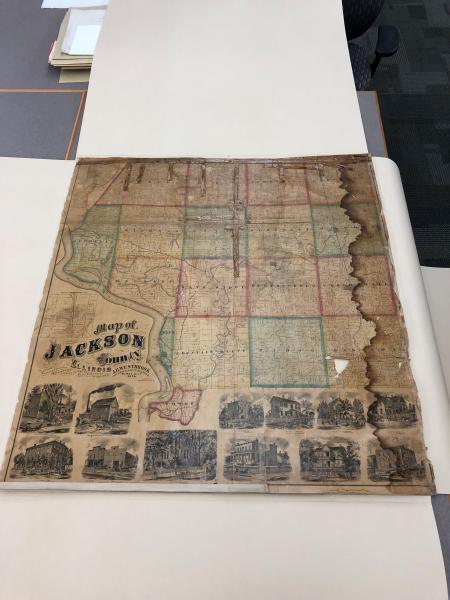
Last year SIUC received a grant from the Illinois State Historical Records Advisory Board to digitize maps that cover the city of Carbondale, Jackson County, and other southern Illinois counties. These maps are important to our region and our university’s mission. The collection can be viewed here: http://collections.carli.illinois.edu/cdm/landingpage/collection/sic_maps.
In addition to receiving conservation treatment, a number of maps at the University of Illinois are subsequently digitized through the in-house Digitization Services lab and subsequently placed in the Digital Library for access, examples of which can be seen here: https://digital.library.illinois.edu/collections/2a99ff50-a613-0134-2339-0050569601ca-4.
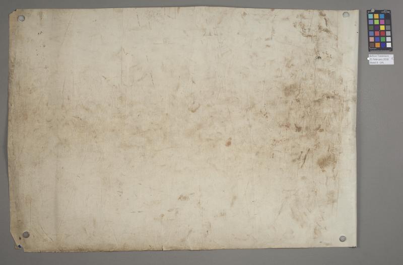
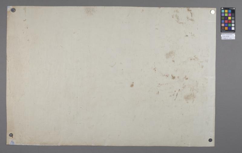
While often very similar to maps in terms of their cumbersome size and damage due to frequent handling prior to library acquisition, blueprints (sometimes known as cyanotypes) present their own unique preservation and conservation challenges. These challenges are sometimes further complicated due to blueprints’ practical application and frequent use for on-the-job reference in construction sites, often resulting in the accumulation of damage in the form of tears, light exposure and fading, as well as dirt or other contaminants often found in the field. Prior to finding their way into a library or archive blueprints often fall victim to the legion of preservation concerns that can be found outside the confines of a safe encapsulation ranging from careless handling and haphazard housing (just think of how frustrating it is to re-fold any large format document, now do this on a construction site and then proceed to use whatever tape you have on hand for immediate repairs), to the use of permanent pens and self-adhesive notes for ad-hoc architectural additions.
As one can see here from the following images blueprints dirt is often caked onto the item, with considerable tears and surface wear. After painstaking conservation work, such as the removal of surface dirt with fine eraser crumbs one can see the difference made on this blueprint from the Urbana Free Library:
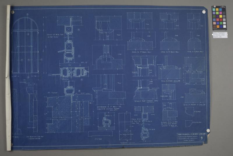
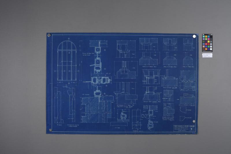
Due to the importance blueprints play in preserving cultural heritage, extensive documentation exists for their continued care and handling. One especially important element of blueprint housing is the need for unbuffered, neutral-pH storage (i.e. folders) as blueprints are especially susceptible to light exposure and alkaline environments. Housing blueprints of similar size in such folders with clearly marked labels near the fold will help discourage patrons from flipping folders open in drawers rather than fully removing them to view as needed. Interleaving each blueprint with unbuffered tissue or polyester cut to match the folder size helps preserve these material.
The University of Illinois’s own Preservation Self-Assessment Program (PSAP) features an extensive write-up regarding proper preservation and conservation techniques for architectural papers: https://psap.library.illinois.edu/advanced-help/paper-unbound-architectural-blueprint.
And, it should be noted that not all items that look like a blueprint or architectural drawing are indeed actual blueprints, see this cheat-sheet for examples of other types of architectural drawing types, many of which present their own unique preservation and conservation challenges:
https://psap.library.illinois.edu/collection-id-guide/summary-archdrawrepro.
References and Additional Resources:
BonaDea, Artemis. Conservation Book Repair: A Training Manual. Alaska State Library, 1995.
“How to Flatten Folded or Rolled Paper Documents”. National Park Service.
“Removing Original Fasteners from Archival Documents”. National Park Service.
Ritzenthaler, Mary Lynn. Preserving Archives & Manuscripts. Chicago, IL: Society of American Archivists, 2010.
Reike, Judith L. (1985) "Keepers of Maps: Some Advice on Preservation". Wilson Library Bulletin, v.60, p.25-27.
Rowlands, Jane. (1997) “The Initial Conservation of an Archive of Rolled Architectural Drawings”. Conservation Journal, issue 24.
Maps of Southern Illinois. Southern Illinois University Carbondale, 2018.
Department of Preservations and Conservation Manual: Encapsulation. Syracuse University Library, 2011.
Harrison, Garry. Indiana University Libraries Book Repair Manual. Indiana University Library, 2016.
Snow, Cason. (2010) Maps for the Ages: An Overview of the Preservation of Sheet Maps. Journal of Map and Geography Libraries, 6:2, 112-128.
Storage Methods and Handling Practices. Northeast Document Conservation Center (NEDCC)
Storage Solutions for Oversized Paper Artifacts. Northeast Document Conservation Center (NEDCC)
Return to Beyond the Book: Preserving your Non-Book Collections